
Perhaps surprisingly, land surveying as we know it today, a mathematical discipline utilising complex technological measuring instruments is very much a product of the practical mathematics of the Renaissance. Why surprisingly? Surveying is an ancient discipline that has its origins in humanity becoming settled many thousands of years ago. Ancient monuments such as the pyramids or Stonehenge definitely required some level of surveying in their construction and there are surviving documents from all literate ancient societies that refer to methods or the practice of surveying.
All surveying uses some aspects of geometry and as Herodotus famously claimed geometry (Greek: geōmetría from geōmétrēs), which literally means measurement of earth or land, had its origins in Egyptian surveying for tax purposes. According to his account, King Sesostris divided all the lands in Egypt amongst its inhabitants in return for an annual rent. However, every year the Nile floods washing away the parts of the plots:
The country is converted into a sea, and nothing appears but the cities, which looked like islands in the Aegean.
Those whose land had been lost objected to paying the rent, so Sesostris summoned those affected to appear before him.
Upon which, the king sent persons to examine, and determine by measurement the exact extent of the loss: and thenceforth only such a rent was demanded of him as was proportionate to the reduced size of his land. From this practice, I think, geometry first came to be known in Egypt, whence it passed into Greece.
According to legend, both Thales and Pythagoras, are reputed to have learnt their geometry in Egypt.
In all early cultures surveying was fairly primitive with measurements being made with ropes and measuring rods. In Egypt, surveyors were known as rope stretchers (harpedonaptai), the ropes used for measuring being stretched to avoid sagging.
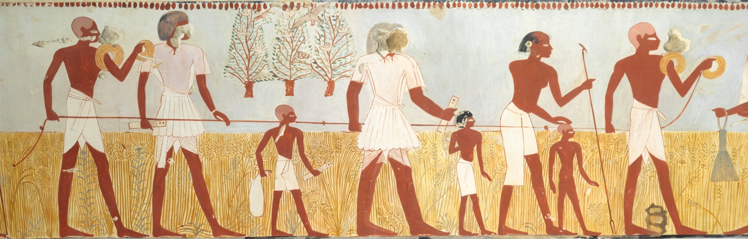
Longer distances were either measured by estimation or by pacing. In ancient Egypt and Greece Bematistae (step measurer) where trained to walk with equal length paces and the historical records of Alexander the Great’s campaigns suggest that they were indeed highly accurate. This measuring of distances by pacing in reflected in our word mile, which is the Latin word for a thousand, mille, meaning a thousand paces.
The Latin for surveyor was agrimensores, meaning field measurers. They were also called gromatici after the groma a surveyor’s pole, an early instrument for determining lines at right angles to each other.
The groma or gruma was a Roman surveying instrument. It comprised a vertical staff with horizontal cross-pieces mounted at right angles on a bracket. Each cross piece had a plumb line hanging vertically at each end. It was used to survey straight lines and right angles, thence squares or rectangles. They were stabilized on the high ground and pointed in the direction it was going to be used. The helper would step back 100 steps and place a pole. The surveyor would tell him where to move the pole and the helper would set it down.
(Lewis, M. J. T., Surveying instruments of Greece and Rome, McGraw Hill Professional, 2001, p. 120)

Another instrument used for the same purpose was the dioptra. The dioptra was a sighting tube or, alternatively an alidade, that is a rod with a sight at each end, attached to a stand. If fitted with protractors, it could be used to measure angles. Hero from Alexandria wrote a whole book on this instrument and its use but there are doubts that the dioptra in the complex form described by Hero was actually used in field surveying.

The methods used by the Romans in field surveying were described in the works of technical authors such as Sextus Julius Frontinus (c. 40–103 CE) and Gaius Julius Hyginus (c. 64 BCE–17 CE).
All of the surveying described in antiquity was fairly small scale–measuring fields, determining boundaries, laying out military camps, etc–and geometrically centred on squares and rectangles. Cartography was done using astronomical determinations of latitude and longitude, whereby the latter was difficult, and distances estimated or paced. Nothing really changed in Europe during the medieval period. The surveying that was done was carried out using the same methods that the Romans had used. However, during the fifteenth century things began to change substantially and the first question is why?
The rediscovery of Ptolemaeus’ Geographia at the beginning of the fifteenth century, as described here, and the subsequent substantial increase in cartographical activity, as described here, played a major role, but as already stated above Ptolemaic cartography relied almost exclusively on astronomical methods and did not utilise field surveying. However, there was an increased demand for internal accuracy in maps that astronomical methods could not supply. Secondly, changes in land ownership led to an increased demand for accurate field surveying of estates that required more sophisticated methods than those of the agrimensores. Lastly, we have a good example of the knowledge crossover, typical for the Renaissance, as described in Episode V of this series. The surveyors of antiquity were artisans producing practical knowledge for everyday usage. In the Renaissance, university educated scholars began to interest themselves for this practical knowledge and make contributions to its development and it is these developments that we will now look at.
The biggest change in surveying was the introduction of the simple geometrical figure the triangle into surveying, as Sebastian Münster, one of the most influential cosmographers (today we would say geographer) of the period, wrote in a German edition of his Cosmographia. Beschreibung aller Lender durch Sebastianum Münsterum in 1550:
Every thing you measure must be measured in triangles.
Actually, the theory of similar triangles, as explained in Euclid’s Elements, had been used in surveying in antiquity, in particular to determine the height of things or for example the width of a river. A method that I learnt as a teenager in the Boy Scouts.

What was new as we will see was the way that triangles were being used in surveying and that now it was the angles of the triangles that were measured and not the length of the sides, as in the similar triangles’ usage. We are heading towards the invention and usage of triangulation in surveying and cartography, a long-drawn-out process.
In his Ludi rerum mathematicarum (c. 1445), the architect Leon Battista Alberti describes a method of surveying by taking angular bearings of prominent points in the area he is surveying using a self-made circular protractor to create a network of triangles. He concludes by explaining that one only needs to the length of one side of one triangle to determine all the others. What we have here is an early description of a plane table surveying (see below) and step towards triangulation that, however, only existed in manuscript

Münster learnt his geometry from Johannes Stöffler (1452–1531), professor for mathematics in Tübingen, who published the earliest description of practical geometry for surveyors. In his De geometricis mensurationibus rerum (1513),
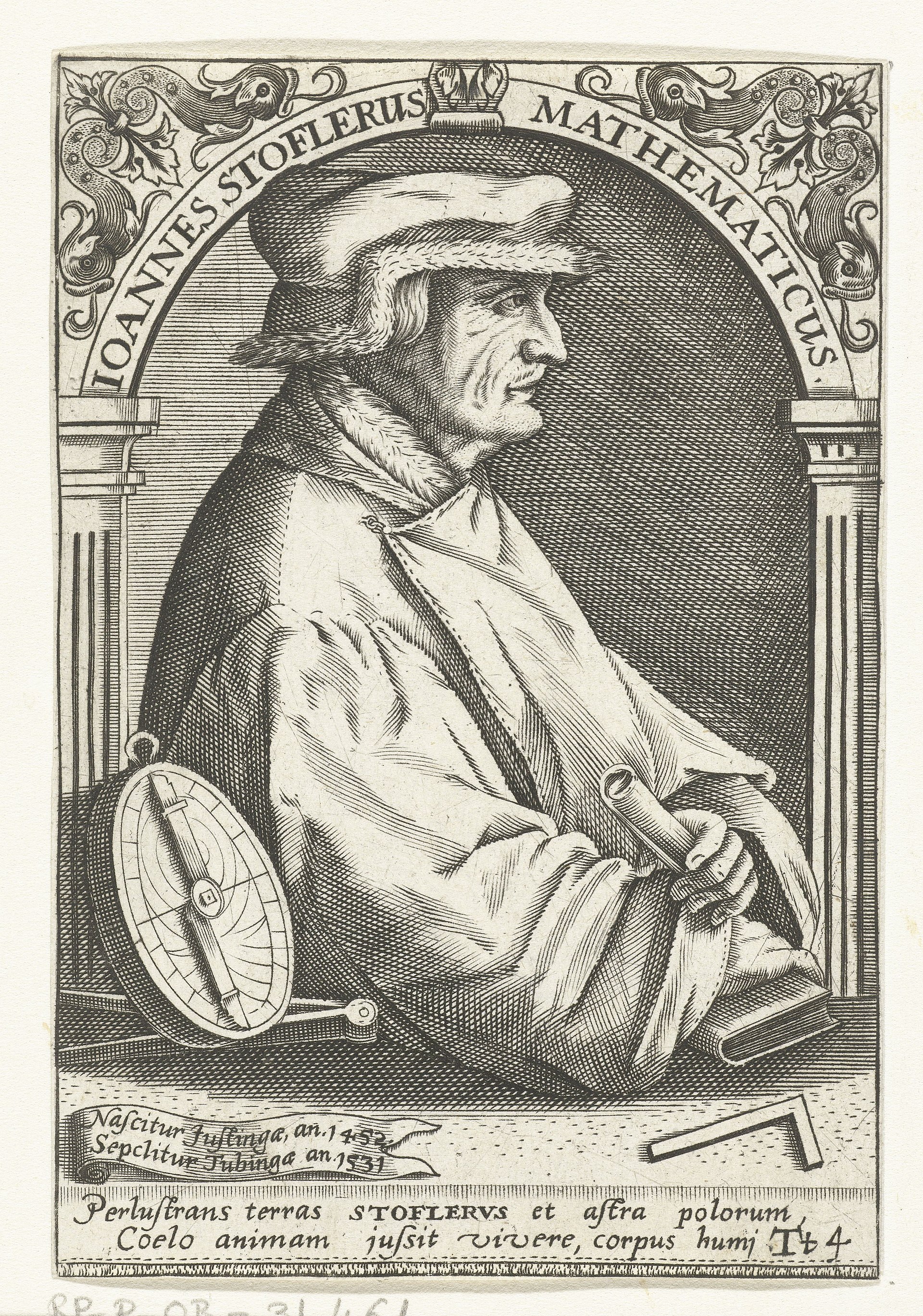
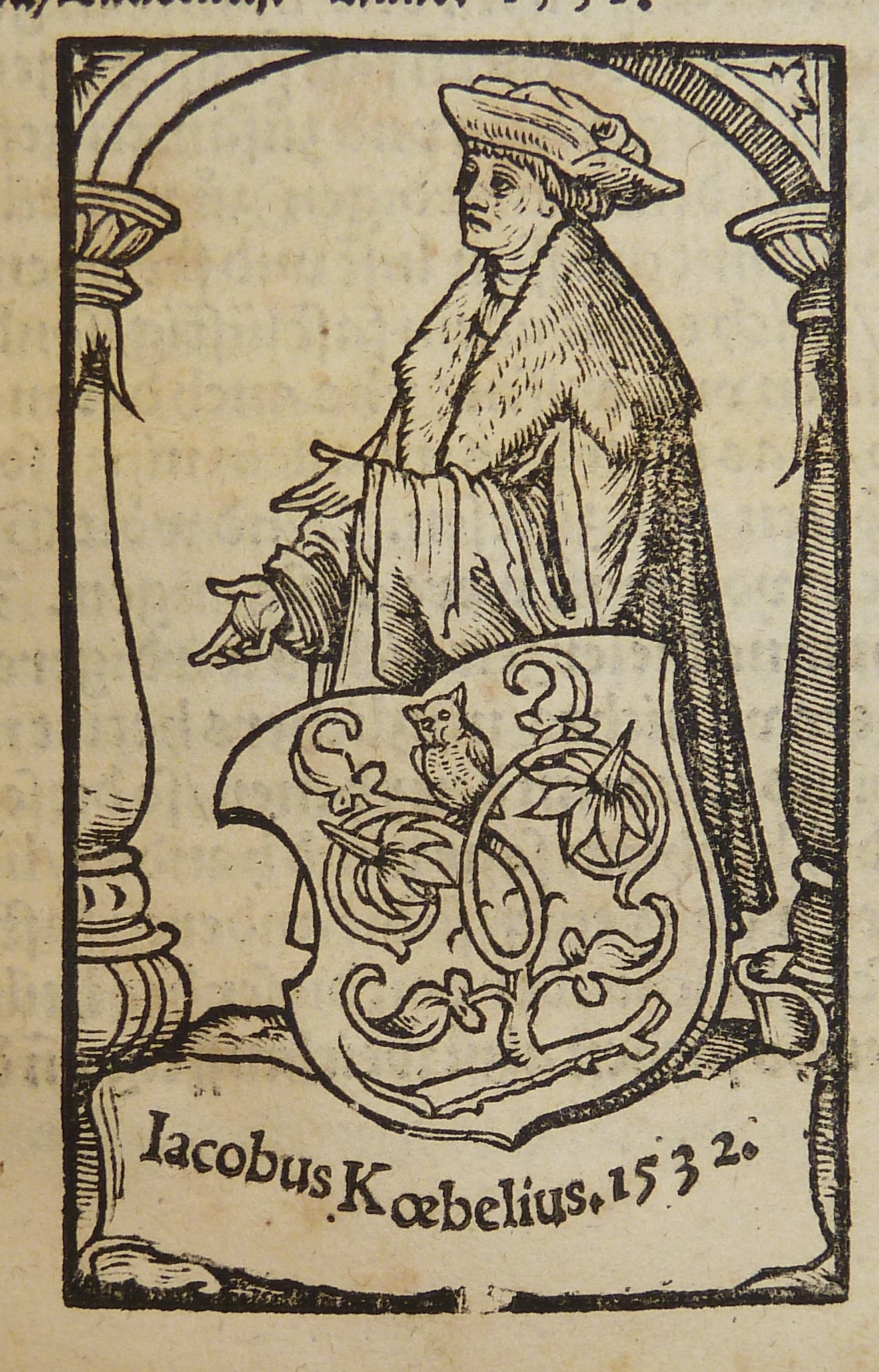
Stöffler explained how inaccessible distances could be measured by measuring one side of a triangle using a measuring rod (pertica) and then observing the angles from either end of the measured stretch. However, most of the examples in his book are still based on the Euclidian concept of similar triangles rather than triangulation. In 1522, the printer publisher Joseph Köbel, who had published the Latin original, published a German version of Stöffler’s geometry book.
Both Peter Apian in his Cosmographia (1524) and Oronce Fine in his De geometria practica (1530) give examples of using triangles to measure distances in the same way as Stöffler.

Fine indicating that he knew of Stöffler’s book. Apian explicitly uses trigonometry to resolve his triangles rather than Euclidian geometry. Trigonometry had already been known in Europe in the Middle Ages but hadn’t been used before the sixteenth century in surveying. Fine, however, still predominantly used Euclidian methods in his work, although he also, to some extent, used trigonometry.
A very major development was the publication in 1533 of Libellus de locorum describendum ratione (Booklet concerning a way of describing places) by Gemma Frisius as an appendix to the third edition of Apian’s Cosmographia, which he edited, as he would all edition except the first. Here we have a full technical description of triangulation published for the first time. It would be included in all further editions in Latin, Spanish, French, Flemish, in what was the most popular and biggest selling manual on mapmaking and instrument making in the sixteenth and seventeenth centuries.

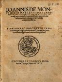
1533 also saw the publication in Nürnberg by Johannes Petreius (c. 1497–1550) of Regiomontanus’s De triangulis omnimodis (On triangles of every kind) edited by the mapmaker and globe maker, Johannes Schöner (1477–1547).

This volume was originally written in 1464 but Regiomontanus died before he could print and publish it himself, although he had every intention of doing so. This was the first comprehensive work on trigonometry in Europe in the Early Modern Period, although it doesn’t cover the tangent, which Regiomontanus handled in his Tabula directionum (written 1467, published 1490), an immensely popular and oft republished work on astrology.
Regiomontanus built on previous medieval works on trigonometry and the publication of his book introduces what Ivor Grattan Guinness has termed The Age of Trigonometry. In the sixteenth century it was followed by Rheticus’ separate publication of the trigonometrical section of Copernicus’s De revolutionibus, as De lateribus et angulis triangulorium in 1542. Rheticus (1514–1574) followed this in 1551 with his own Canon doctrinae triangulorum. This was the first work to cover all six trigonometric functions and the first to relate the function directly to triangles rather than circular arcs.

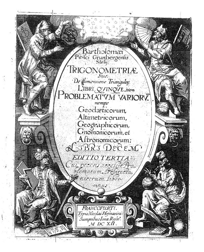
Rheticus spent the rest of his life working on his monumental Opus Palatinum de Triangulis, which was, however, first published posthumously by his student Lucius Valentin Otho in 1596. Rheticus and Otho were pipped at the post by Bartholomaeus Pitiscus (1561–1613), whose Trigonometria: sive de solutione triangulorum tractatus brevis et perspicuous was published in 1595 and gave the discipline its name.
Pitiscus’ work went through several edition and he also edited and published improved and corrected editions of Rheticus’ trigonometry volumes.
Through Gemma Frisius’ detailed description of triangulation and sixteenth century works on trigonometry, Renaissance surveyors and mapmakers now had the mathematical tools for a new approach to surveying. What they now needed were the mathematical instruments to measure distances and angles in the field and they were not slow in coming.
The measure a straight line of a given distance as a base line in triangulation surveyors still relied on the tools already used in antiquity the rope and the measuring rod. Ropes were less accurate because of elasticity and sagging if used for longer stretches. In the late sixteenth century, they began to be replaced by the surveyor’s chain, made of metal links but this also suffered from the problem of sagging due to its weight, so for accuracy wooden rods were preferred.
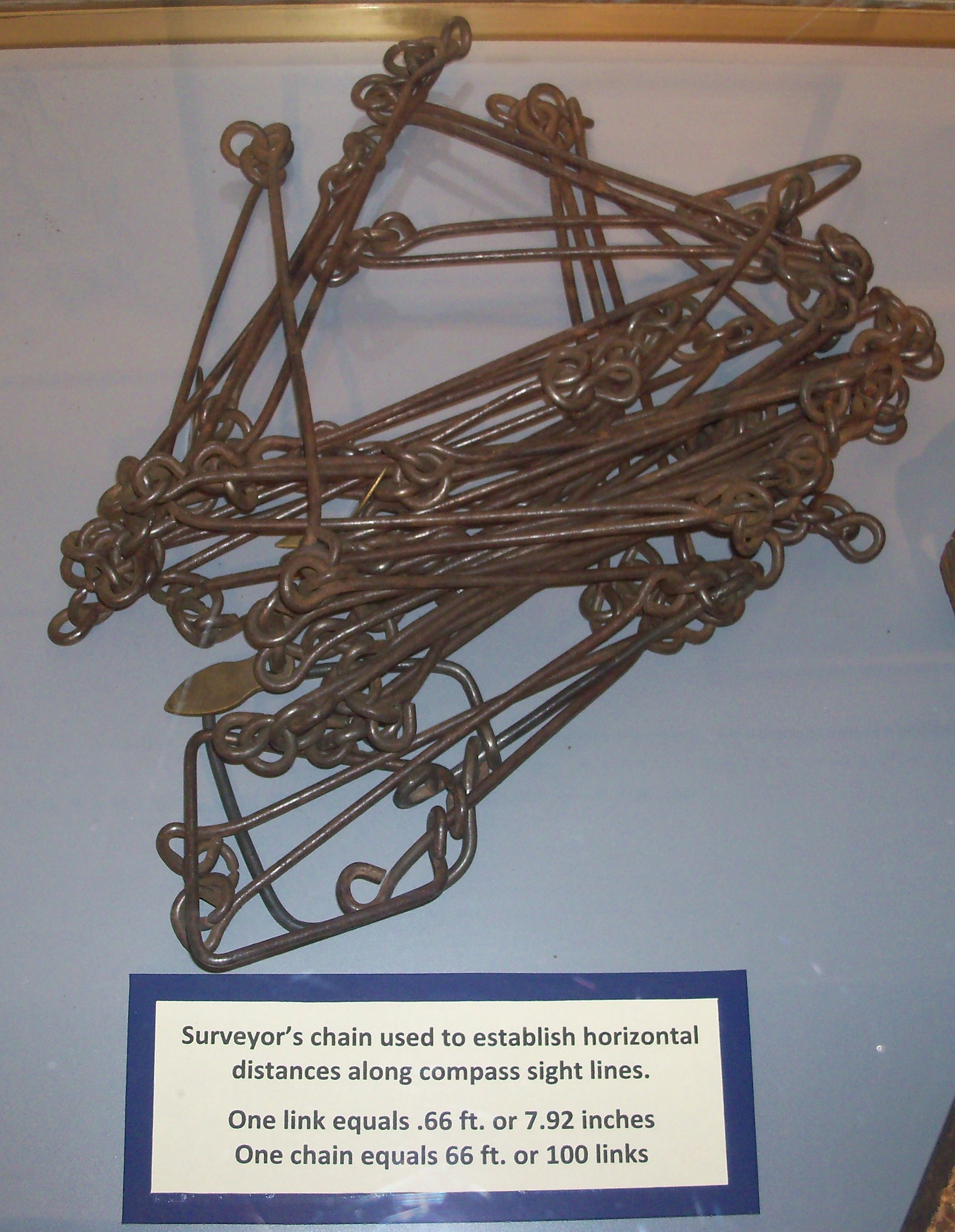
In English the surveyor’s chain is usually referred to as Gunter’s chain after the English practical mathematician Edmund Gunter (1581–1626) and he is also often referred to erroneously as the inventor of the surveyor’s chain but there are references to the use of the surveyor’s chain in 1579, when Gunter was still a child.
He did, however, produce what became a standardised English chain of 100 links, 66 feet or four poles, perches, or rods long, as John Ogilby (1600–1676) wrote in his Britannia Atlas in 1675:
…a Word or two of Dimensurators or Measuring Instruments, whereof the mosts usual has been the Chain, and the common length for English Measures 4 Poles, as answering indifferently to the Englishs Mile and Acre, 10 such Chains in length making a Furlong, and 10 single square Chains an Acre, so that a square Mile contains 640 square Acres…’
An English mile of 5280 feet was thus 80 chains in length and there are 10 chains to a furlong. An acre was 10 square chains. I actually learnt this antiquated system of measurement whilst still at primary school. The name perch is a corruption of the Roman name for the surveyor’s rod the pertica.
To measure angles mapmakers and surveyors initially adopted the instruments developed and used by astronomers, the Jacob staff, the quadrant, and the astrolabe. An instrument rarely still used in astronomy but popular in surveying was the triquetum of Dreistab. The surveyors triquetum consists of three arms pivoted at two points with circular protractors added at the joints to measure angles and with a magnetic compass on the side to determine bearings.

Surveyors then began to develop variants of the dioptra. The most notable of these, that is still in use today albeit highly modernised, was the theodolite, an instrument with sights capable of measuring angles both vertically and horizontally. The name first occurs in the surveying manual A geometric practice named Pantometria by Leonard Digges (c. 1515–c. 1559) published posthumously by his son Thomas (c. 1546–1595) in 1571.

However, Digges’ instrument of this name could only measure horizontal angles. He described another instrument that could measure both vertical and horizontal angles that he called a topographicall instrument. Josua Habermehl, about whom nothing is known, but who was probably a relative of famous instrument maker Erasmus Habermehl (c. 1538–1606), produced the earliest known instrument similar to the modern theodolite, including a compass and tripod, in 1576. In 1725, Jonathan Sisson (1690–1747) constructed the first theodolite with a sighting telescope.

A simpler alternative to the theodolite for measuring horizontal angles was the circumferentor. This was a large compass mounted on a plate with sights, with which angles were measured by taking their compass bearings.

Instruments like the triquetum and the circumferentor were most often used in conjunction of another new invention, the plane table. Gemma Frisius had already warned in his Libellus de locorum describendum rationeof the difficulties of determining the lengths of the sides of the triangles in triangulation using trigonometry and had described a system very similar to the plane table in which the necessity for these calculation is eliminated.

The plane table is a drawing board mounted on a tripod, with an alidade. Using a plumb bob, the table is centred on one end of a baseline, levelled by eye or after its invention (before 1661) with a spirit level, and orientated with a compass. The alidade is placed on the corresponding end of the scaled down baseline on the paper on the table and bearings are taken of various prominent features in the area, the sight lines being drawn directly on the paper. This procedure is repeated at the other end of the baseline creating triangles locating the prominent figures on the paper without having to calculate.

As with the theodolite there is no certain knowledge who invented the plane table. Some sources attribute the invention of the plane table to Johannes Praetorius (1537–1616), professor for mathematics at the University of Altdorf, as claimed by his student Daniel Schwentner (1585–1636). However, there was already a description of the plane table in “Usage et description de l’holomètre”, by Abel Foullon (c. 1514–1563) published in Paris in 1551. It is obvious from his description that Foullon hadn’t invented the plane table himself.
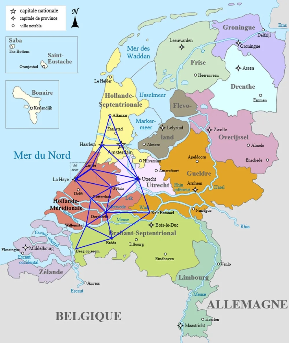
The plane table is used for small surveys rather than mapmaking on a large scale and is not triangulation as described by Gemma Frisius. Although the Renaissance provided the wherewithal for full triangulation, it didn’t actually get used much for mapping before the eighteenth century. At the end of the sixteenth century Tycho Brahe carried out a triangulation of his island of Hven, but the results were never published. The most notable early use was by Willebrord Snel (1580–1626) to measure one degree of latitude in order to determine the size of the earth in 1615. He published the result in his Eratosthenes batavus in Leiden in 1617. He then extended his triangulation to cover much of the Netherlands.
In the late seventeenth century Jean Picard (1620–1682) made a much longer meridian measurement in France using triangulation.

In fourteen hundred European surveyors were still using the same methods of surveying as the Romans a thousand years earlier but by the end of the seventeenth century when Jean-Dominique Cassini (1625–1712) began the mapping of France that would occupy four generations of the Cassini family for most of the eighteenth century, they did so with the fully developed trigonometry-based triangulation that had been developed over the intervening three hundred years.


Louis XIV’s comment that the astronomers (Cassini and his co-workers) had taken more land from him than his enemies illustrates one problem with the traditional approach to surveying, that of systematic errors which tended to over-estimate the size of the country. The map of France from Recueil d’ Observations (Paris, 1693) which was based on Cassini’s use of the moons of Jupiter for determining time for longitude measurements illustrates this.
Which you can view on the side linked to Picard’s name in the text above
No discussion of a chain is complete without noting that it is the unit of measurement for the length of a cricket pitch, and thus in use all over the world to this day.
🙃